From the US-412 bypass around Mountain Home take AR-201 south for 10 miles. Turn right on AR-341 South and drive 1.4 miles. The trailhead parking will be on the right.
Note: Clicking on any of the icons in the embedded map below will also open an information window. Within the red bar in that window, you can click on the ↱ to get Google driving directions from your current location.
The Trail
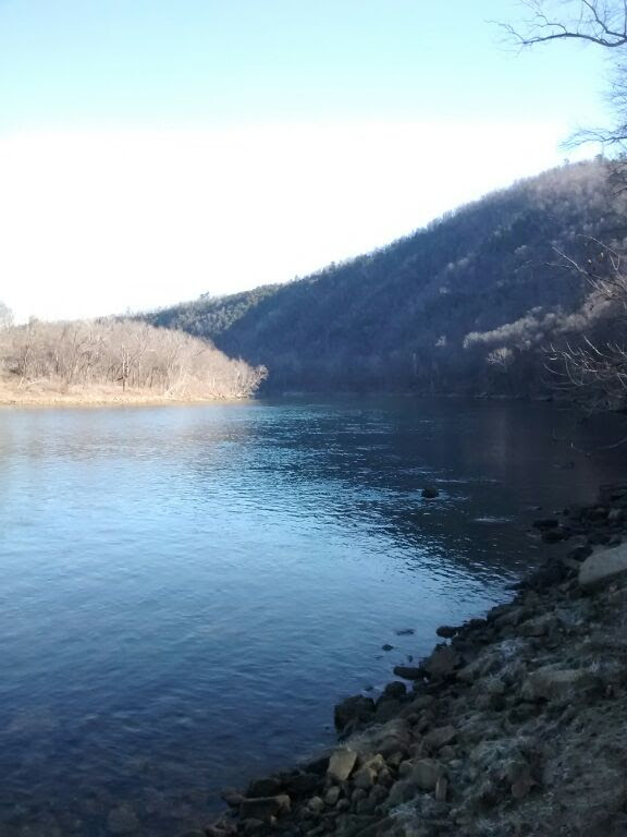
This hike starts at the Ozarks Highlands Trailhead on Push Mountain Road (341) partway up Matney Mountain. The first two miles traverse the mountain -- at one point providing a nice view of the river valley below.
The trail then crosses 341 twice before heading steeply downhill to Matney Camp. Note that there is a sharp right turn shortly after the first crossing of 341. If you miss this turn and go straight, you will be continuing along the Ozark Highlands Trail which continues for nearly 200 miles! Stay alert!
You'll find lovely stands of Southern Pine, a view of the White River from a high bluff, a winding trail down to the river through and around craggy ledges, and abundant wildflowers on the hillside above the river.
6.2 miles round trip. Moderate difficulty.
Click on this link to see an interactive map of the trail showing the elevation changes.
The Map
Clicking on this link will open the embedded map below in a separate window and allow you to use Google's My Maps app on your phone. Clicking on the various icons in the embedded map below (or in My Maps) will show you photographs of a few things you can expect to see.


Thank you for all your efforts to make this information available!
ReplyDelete